When a tunnel corridor floods — partially or fully — LiDAR stops working at the waterline. That's not a subtle limitation; it's a hard physics boundary. Laser light doesn't propagate through turbid water at useful ranges, and even a few centimeters of surface scattering eliminates the point cloud fidelity you need for structural mapping. Sonar, by contrast, was built for exactly this environment. But sonar has its own failure modes in dry corridors — multipath echo confusion, surface texture ambiguity, and poor performance in narrow, acoustically-hard passages. We've spent the better part of two years running both modalities in the same corridors under varying water conditions, and the answer to "which one?" is almost always "it depends on which part of the corridor you're in."
What LiDAR does well underground (when it's dry)
In dry corridors, LiDAR produces point clouds that are genuinely difficult to match by any other method. A 360-degree rotating LiDAR at 100k points-per-second can resolve wall texture, support structure spacing, and floor geometry with centimeter-level fidelity at ranges out to 30 meters depending on surface reflectivity. For structural mapping — where you're trying to understand corridor dimensions, branching geometry, and obstacle placement — there's no competitive alternative in air.
The practical challenges underground are dust and particulates. Active tunnel environments with foot or vehicle traffic stir aerosol-density material that scatters forward at densities LiDAR wasn't designed to handle. We've seen effective range drop from 25m to under 8m in high-particulate conditions with no change to the sensor configuration. For surveillance applications where you're operating in passages with recent human activity, dust management isn't a side problem — it's central to whether the mapping run is useful.
Reflective surfaces also create artifacts. Wet rock faces, metallic infrastructure, and standing water pools produce specular returns that appear in the point cloud as phantom walls or surfaces. Post-processing filters help, but they also have a tendency to remove real structural features that happen to have high reflectance. Getting this right requires tuning the filter parameters to the specific geology, which means the first mapping pass in a new environment is never the clean one.
Sonar performance in flooded passages
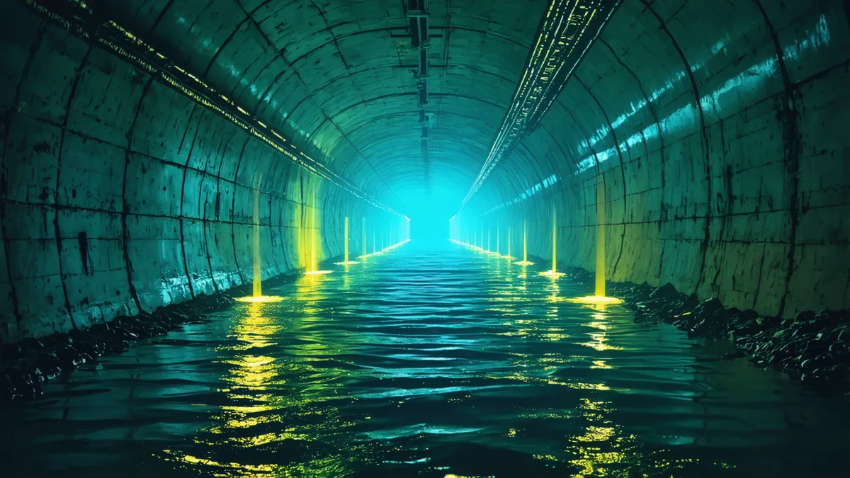
Multibeam sonar in flooded underground corridors gives you something LiDAR cannot: a map of the submerged geometry. For partially flooded tunnels — which constitute the majority of what we encounter in operational scenarios — sonar handles the water column and bottom profile while LiDAR handles the above-water walls and ceiling. The challenge is stitching these two datasets into a coherent three-dimensional model when the sensors are on different platforms operating at different times.
Single-beam sonar is simpler to integrate but produces a profile rather than a map — you get cross-sectional snapshots rather than continuous coverage. Multibeam systems generate the coverage needed for structural assessment but add weight, power draw, and acoustic complexity. In confined tunnel cross-sections, the acoustic multipath from sonar in a hard-walled 2m diameter passage is significant. Returns from the near walls arrive within microseconds of the primary return, and at some angles they're indistinguishable without careful aperture control.
Water chemistry matters more than most sonar users expect. High silt content degrades the acoustic image in the same way dust degrades LiDAR — suspended particulates scatter the ping before it reaches the target. We found that water turbidity above roughly 200 NTU reduced effective sonar range by 40% in our test conditions, a threshold that's easily exceeded in passages with sediment disturbance from recent foot traffic or construction activity.
The combined-modality approach and its integration costs
The obvious answer is to run both, and for comprehensive mapping campaigns, we do. But the integration cost is non-trivial. The two modalities operate on different timestamping regimes, produce different data formats, and require different platform geometries. A platform optimized for LiDAR — typically a surface-traversing wheeled or tracked vehicle — isn't the right platform for sonar in a flooded passage. Tethered aquatic platforms work for the water column but have limited utility above the waterline.
We've had the most success with a two-phase approach: LiDAR pass first to map dry sections and produce the structural reference frame, followed by a sonar platform that ingests the LiDAR-derived corridor geometry as a prior for its navigation. The sonar platform knows roughly where the walls are above water from the LiDAR data, which improves acoustic processing confidence for the submerged section. The two datasets are registered to a common coordinate system using structural features at the air-water interface — typically wall corners or visible infrastructure that appears in both datasets.
This approach adds time and complexity to every mapping campaign. In surveillance contexts where you need rapid coverage, the two-platform, two-pass requirement is a real constraint. We're working on a hybrid carrier concept that accommodates both sensors on a single amphibious platform, but the engineering tradeoffs in a 1.5m-diameter passage are substantial.
Decision criteria for modality selection
For operational planning purposes, we use a simple decision tree based on known corridor conditions. If the target section is dry with low particulate activity, LiDAR is the primary mapping modality and sonar isn't deployed. If the section is fully submerged or has water depths exceeding 20cm, sonar is primary and LiDAR coverage is limited to above-water geometry if accessible. For the mixed case — partial flooding with significant air space — we run both with the coordination protocol described above.
There's a third category that doesn't fit neatly: passages with unpredictable flooding that may change between a mapping pass and a follow-on operational entry. In those cases we map with LiDAR for structural reference, accept that the flooded sections aren't fully characterized, and use the structural map to inform where sonar would be most valuable in a secondary pass. The goal is decision-quality data fast, not perfect data slow.
Remaining open problems
Fusing LiDAR and sonar into a single real-time navigation prior is harder than it looks on paper. The latency profiles differ by an order of magnitude — LiDAR returns are available within milliseconds, sonar ping cycles run 50–200ms depending on range — and a navigation system that ingests both without temporal aliasing requires careful timestamp management. We haven't solved this cleanly for the amphibious platform case. The two-pass campaign approach sidesteps the real-time fusion problem at the cost of operational agility.
Surface reconstruction from sonar in complex geometry — branching passages, alcoves, collapsed sections — remains unreliable enough that we treat sonar-derived geometry as a constraint rather than a map. It tells you what's there but not precisely where. For navigation, that's often sufficient. For structural assessment, it isn't. Closing that gap is an active area of work.