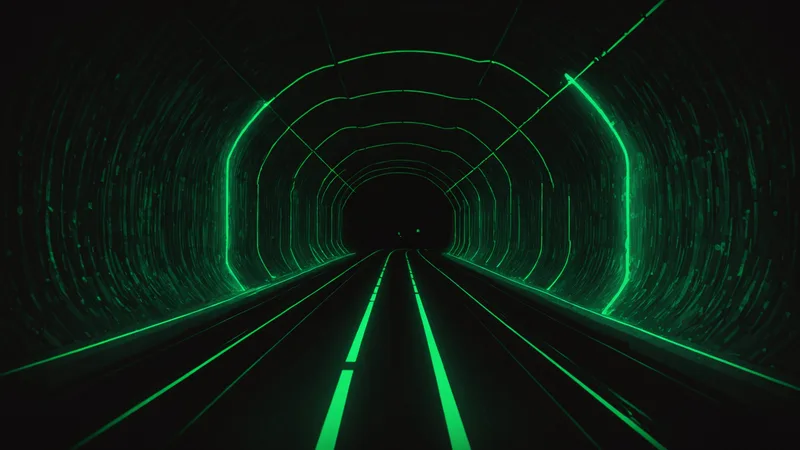
Every navigation problem in robotics eventually becomes a localization problem: the vehicle needs to know where it is, with enough accuracy, to do something useful. Surface-based autonomous systems have GPS as a reliable absolute position anchor. Underground, that anchor is gone. What remains is a combination of dead reckoning, map matching, and opportunistic correction — each with characteristic failure modes that our current architecture attempts to manage without fully solving.
This article describes the navigation approach we've built for our autonomous effector platform in GPS-denied tunnel corridors. We're not presenting this as a solved problem. The dead reckoning drift accumulation that fundamentally limits inertial-only navigation is a physics constraint we're working around, not through. Our architecture attempts to contain drift within operationally acceptable bounds by periodic correction against pre-mapped landmarks. The error budgets below reflect our current testing results, which have not been independently validated.
Dead Reckoning and the Drift Accumulation Problem
Dead reckoning computes position by integrating velocity over time from a known starting point. In an inertial measurement unit (IMU), velocity is derived by integrating acceleration measurements from the accelerometer triad. The integration process means that any small constant error in the accelerometer readings accumulates as a linearly growing position error over time. In MEMS-grade IMUs — the class of inertial sensors that fits within a compact autonomous platform — typical accelerometer bias errors are on the order of 0.1–1 mg (milli-g). Integrating a 0.5 mg bias over 60 seconds of travel at 1 m/s produces a position error of approximately 88 cm. Over 5 minutes, that error grows to roughly 22 meters.
Tactical-grade IMUs (fiber optic gyroscopes, ring laser gyros) achieve bias stability two to three orders of magnitude better, which extends the dead reckoning validity period significantly. But they are expensive, large, and consume significant power — constraints that conflict with our design requirement for small, low-power autonomous nodes. MEMS IMUs are the right answer for the platform class we're building; we just need to correct their drift aggressively and often.
Wheel odometry and inertial odometry (combining IMU with ground speed estimation from wheel encoders or visual flow) improve on pure IMU integration by reducing velocity integration error. But they introduce their own error sources: wheel slip on rough tunnel floors, encoder backlash, surface irregularities. Inertial odometry is a useful first layer, not a complete solution. Our current system uses six-axis IMU fusion with optical flow from a downward-facing camera as the baseline dead reckoning stack, with correction events applied when map features are matched.
Preloaded LiDAR Map Registration (SLAM-Lite)
The approach we've found most tractable for tunnel corridors is pre-survey LiDAR mapping followed by scan matching during deployment. Before operational use, the tunnel corridor is surveyed with a handheld or robot-mounted LiDAR unit to create a 3D point cloud map of the environment. That map is stored on the effector's onboard processor. During operation, the effector's onboard LiDAR (we're using a compact single-plane unit for size and power reasons) continuously scans the tunnel cross-section and matches the observed scan geometry against the stored map.
This is a simplified variant of Simultaneous Localization and Mapping (SLAM) — "SLAM-lite" in the sense that we're not building the map at runtime, we're localizing against a pre-built map. Full SLAM is computationally expensive and requires loop closure detection; in a linear tunnel environment with a pre-built map, the problem reduces significantly. The tunnel corridor cross-section is distinctive in ways that allow robust scan matching: wall distance profiles, pillar locations, junction geometry, ceiling height variations all serve as discriminating features.
The failure modes are worth noting explicitly. Scan matching degrades in featureless sections — long straight uniform-diameter tunnels where successive cross-section scans are nearly identical offer limited discriminating geometry. Our map registration algorithm can lose track of absolute position in these sections, falling back to dead reckoning until a distinctive feature is encountered. Tunnel modifications (added equipment, partial blockage, debris) create scan-to-map mismatches that can confuse the matcher. These are known limitations of the current system that we are actively working on but have not resolved.
Acoustic Landmark Matching
Acoustic properties of a tunnel corridor — reverberation time (RT60), frequency response peaks from standing wave resonance, reflective geometry — are deterministic functions of the corridor geometry at any given location. In a corridor that has been acoustically characterized during the pre-deployment survey, the acoustic response signature at each position is a passive fingerprint that doesn't require powered landmarks or external infrastructure.
Our system uses the effector's own acoustic emission (from its drive motors and chassis) as a sound source, and measures the impulse response at a forward-facing microphone pair. That measured response is matched against the stored acoustic map to produce a position estimate. The acoustic correction event is computationally lightweight and can run concurrently with the LiDAR scan matching pipeline.
This approach was partially inspired by mine rescue robot work — specifically, the challenge of navigating re-entry robots through collapsed mine sections where LiDAR might be blocked by debris but acoustic characteristics of the corridor geometry are still measurable through the rubble. We're not the first team to think about acoustic landmark matching for underground navigation; the mine rescue robot community documented similar concepts in the years following the DARPA Subterranean Challenge. Our implementation differs in the sensor payload and the integration with a pre-built acoustic map rather than online acoustic map building.
The acoustic approach has one significant limitation we're transparent about: it requires the acoustic environment to be stable between survey and deployment. Flowing water, ventilation fans, and other continuous noise sources corrupt the impulse response measurement, making the matching unreliable. In tunnels with active ventilation or drainage systems, the acoustic landmark approach is not viable as a primary correction mechanism; we fall back to LiDAR-only correction in those environments.
Comparison with Mine-Rescue Robot Navigation
The mine rescue robotics community — DARPA's Subterranean Challenge (SubT) teams, CMU's DARPA SubT program, and post-SubT commercial spinoffs — has produced the most mature GPS-denied underground navigation systems available in open literature. Their operational context differs from ours in ways that matter for the navigation architecture.
SubT robots operated in exploration mode: unknown environments, no pre-built maps, required online SLAM for map building, operated for hours under tele-operation with intermittent autonomy. Their navigation challenge was primarily about exploration and mapping in unknown space. Our operational context is in some ways easier: pre-mapped corridors, constrained geometry (linear or near-linear), shorter mission durations (minutes rather than hours), and a much tighter position accuracy requirement for effector targeting (meter-scale versus the 5-10 m accuracy that was adequate for SubT competition objectives).
The tighter accuracy requirement is actually what drives our architecture away from the full SLAM approach used by SubT teams. Full SLAM accumulates drift between loop closure events; in a linear corridor without natural loop closure opportunities, SLAM's error bounded performance degrades toward dead reckoning. Our pre-built map registration approach gives us position corrections at every distinctive feature encounter, which in a well-surveyed corridor can be as frequent as every 3–5 meters — far more frequent than SubT loop closure events.
Where Our Architecture Stands
Our current architecture achieves what we'd characterize as operationally useful navigation performance in pre-mapped linear corridors under favorable conditions: position error below 1.5 m after 100 m of autonomous traversal in a concrete-lined tunnel with good feature density. In soft-soil tunnels with lower feature density, we're seeing 2.5–4 m position error over the same distance. Neither figure has been validated outside our own test environments.
We're not claiming to have solved GPS-denied navigation for underground platforms. Dead reckoning drift is a physics problem with no fully satisfying software solution at MEMS sensor grades. What we've built is a pragmatic correction architecture that keeps drift within operationally relevant bounds for the mission durations and corridor types we're targeting. The open problems — featureless section robustness, acoustic matching in noisy environments, handling corridor modifications post-survey — remain active development areas. Any procurement evaluation of our effector navigation should account for those limitations explicitly.